On a planet where water security is redefined every decade by the advance of climate change, the coastal basins of northern Peru are fighting a silent but critical battle. Overexploitation of agricultural wells, combined with rising marine groundwater levels and more frequent droughts, has accelerated saline intrusion into aquifers that once sustained the region’s agricultural production. Today, every cubic meter degraded by excessive salts represents not only a productive loss but also a direct threat to the food and economic resilience of thousands of families.
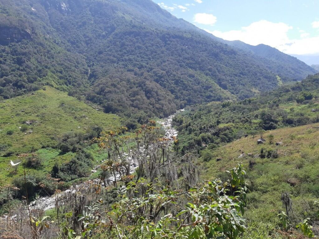
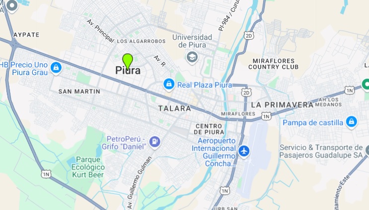
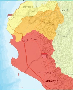
The project is located in the Chira River Valley and Piura area, a strategic agricultural hub for export crops such as mango, banana, and lemon, but where groundwater quality has shown progressive deterioration in electrical conductivity and chloride concentration. In response, the intervention proposes an integrated hydrological restoration: technical sealing of critical wells, managed recharge through green infrastructure, and continuous physico-chemical monitoring, with the goal of halting salinization and restoring aquifer functionality.
The proposal addresses the urgent need to shift groundwater management from reactive to preventive, aligning the strategy with the principles of Volumetric Water Benefit Accounting (VWBA 2.0): additionality (actions that would not occur without the project), intentionality (explicit goal of restoring availability and quality), and traceability (physical and digital measurement and verification of the benefit). Stakeholders include irrigation user boards, local governments, agricultural operators, technology providers, and an independent verification entity.
In a context where the international agricultural market demands water sustainability certifications and traceability, this solution not only recovers volumes and improves water quality but also repositions the region as a replicable model for coastal agricultural areas at risk. The goal is clear: to move from a vicious cycle of degradation and rising costs to a virtuous cycle of water regeneration, production stability, and ESG compliance.
Currently, the aquifer in the Chira and Piura Valley faces a chronic water imbalance: extractions exceed natural recharge, wells operate without flow control, and irrigation returns increase salinity levels. The problem is exacerbated by the lack of specific regulations for managing marine intrusion and by the absence of basin-scale recharge and monitoring infrastructure. The result is a sustained increase in electrical conductivity, with direct impacts on crop yields and agricultural profitability.
The technical opportunity lies in implementing a hydrogeological restoration model that combines structural and management measures: closure or reconversion of wells acting as intrusion pathways, controlled infiltration works to recharge with quality water, and a digital sensor network to measure flows and quality parameters in real time. This combination allows action on root causes rather than symptoms, reducing pressure on the aquifer and improving its net water balance.
In the short term, the project aims to halt the advance of the saline wedge and stabilize critical parameters (conductivity and chlorides) in reference wells. In the medium term, managed recharge will increase the volume available for irrigation during dry seasons, reducing dependence on external sources. In the long term, the project will consolidate participatory water governance, with open data and the ability to replicate in other coastal basins in the country.
This is a scalable model that can be led by agribusiness exporters, producer associations, and water operators, gaining operational resilience, compliance with international standards, and competitive differentiation. Acting now is not just a strategic choice, it is the only way to prevent the irreversible loss of an aquifer that sustains a significant part of the regional agricultural economy.
The technical solution is structured around three complementary pillars:
Remote detection and hydrochemical characterization: Satellite imagery (Sentinel-2 and Landsat 8) and elevation models are used to identify abandoned wells, subsidence zones, salinized areas, and runoff traces. This information is validated through field campaigns using multispectral drones, differential GPS, and groundwater sampling for analysis of EC, chloride, nitrate, sodium adsorption ratio (SAR), and coliforms.
Physical intervention and technical well sealing: Priority is given to wells with the highest hydrochemical risk or vertical connectivity. Sealing is done using controlled cementation techniques, with field-based depth and lithology profiles. Bentonite-cement mixes adapted to saline conditions are used, and post-intervention piezometric monitoring is installed.
Development of managed agricultural recharge zones: Filter strips and vegetated infiltration ditches (using native species such as Prosopis pallida and Typha domingensis) are installed in degraded plots or canal edges. These structures recover agricultural runoff, reduce pollutants, and promote controlled infiltration. They are monitored with soil moisture sensors, flow meters, observation wells, and portable weather stations.
Initial diagnosis (0–2 months): Remote analysis using satellite imagery and elevation maps to identify thermal anomalies, subsidence zones, runoff traces, and potentially abandoned wells. Soil reflectance, NDVI, and seasonal surface moisture changes are measured to generate a geo-referenced preliminary geochemical risk map.
Field inspection (2–4 months): Technical validation of the sites identified in the previous phase. Groundwater levels are measured using piezometric probes, and groundwater samples are analyzed for EC, chloride, nitrate, coliforms, and heavy metals. Each well’s structural condition is inspected and classified using a risk index.
Design and prioritization (3–5 months): A technical intervention plan is developed. Required infiltration rates are calculated, water balances modeled based on climatic and soil conditions, and wells are prioritized based on potential impact. Sealing materials (bentonite, cement, resin) and optimal geometries of infiltration ditches are defined.
Works execution (6–10 months): Hydraulic closure of prioritized wells is performed. Each intervention is documented with material volume, sealing mix type, depth, and date. Simultaneously, vegetated filter strips are constructed, and flow is measured using flow meters and pressure sensors in monitoring chambers.
Continuous monitoring (10–24 months): An automated piezometric sensor network is operated and connected to a real-time data visualization platform. Continuous measurement of EC, chloride levels, water table depth, and accumulated infiltration is performed. External audits are conducted quarterly, and results are reported through the Aqua Positive traceability system.
The in the Chira River Valley and Piura region emerges in response to an accelerated process of hydrogeological degradation that threatens agricultural sustainability, public health, and water resilience in this strategic region of northwestern Peru. The combination of intensive agriculture, outdated irrigation systems, and unplanned urban growth has led to critical overexploitation of the area’s coastal and fluvio-alluvial aquifers. Deep and semi-deep wells—many unlicensed and unmaintained—have disrupted the subsurface piezometric balance, allowing saline intrusion from both marine and deep mineralized zones.
The project area includes alluvial zones of the Chira River and tributaries across districts such as Sullana, Marcavelica, Las Lomas, La Huaca, and Piura. Practices like heavy agrochemical use and flood irrigation have triggered secondary salinization and diffuse contamination of groundwater. This is worsened by soil sealing from informal settlements and untreated domestic discharges.
In response, the project proposes a technically structured intervention: remote detection and hydrochemical characterization of critical wells, progressive hydraulic sealing of high-risk structures, and implementation of managed agricultural recharge areas using nature-based solutions. All actions follow the VWBA and WQBA frameworks, ensuring quantifiable and verifiable groundwater and water quality benefits.
Implementation spans five phases: remote diagnosis, field inspection and water quality testing, technical design and prioritization, execution of well closures and recharge structures, and continuous monitoring with IoT sensors, external auditing, and Aqua Positive traceability.
The intervention benefits the Bajo Chira aquifer and parts of Piura’s coastal system—zones identified by ANA as highly vulnerable. The project aligns with SDGs 2, 3, 6, 13, 15, and 17, supporting water access for irrigation, health, and sustainable production while restoring soil functions and fostering local governance. The validated, permanent, and traceable benefits can be monetized as Positive Water Credits (CAPs), replicable in similar hydrogen.